Super Typhoon Chanthu to come closest to Taiwan on weekend, landfall possible
 ]
]
TAIPEI (Taiwan News) — Chanthu (璨樹) has jumped from a tropical depression to a Category 5 typhoon within 48 hours, and the Central Weather Bureau (CWB) may issue a sea warning for the storm as early as this evening (Sept. 9), but the weather bureau is not ruling out the possibility the storm could make landfall in the country.
As of 2 a.m., Typhoon Chanthu was about 1,170 kilometers southeast of Taiwan’s southernmost tip of Eluanbi, moving west-northwest at a speed of 13 kilometers per hour. It had a radius of 150 km and was packing maximum sustained winds of 190 kph and gusts of up to 234 kph, the CWB reported.
The bureau forecasts that Chanthu will have the greatest impact on Taiwan from Saturday to Monday (Sept. 11-13), starting with showers or thunderstorms in the east and south and heavy rains in the southeast and Hengchun Peninsula on Saturday. On Sunday, heavy rain and thunderstorms are likely across Taiwan, while rain and thunderstorms will likely continue on Monday in the southern, central, and southeastern regions, with scattered showers in other areas.
Meteorologist Wu Der-rong (吳德榮) said today that Chanthu is a rare and extremely fast-strengthening typhoon and already the “strongest typhoon” to threaten Taiwan so far this year. He predicted that the periphery of the typhoon will begin to bring rain to the country Friday evening (Sept. 10).
Wu said that from Saturday to Monday, Chanthu will bring powerful winds and torrential rain He said that the extent of precipitation will vary depending on the region and the path the storm takes.
The latest CWB model projects that Chanthu will first enter the Bashi Channel to the south of Taiwan before veering north and delivering a glancing blow on the southwestern coast. However, models by the Joint Typhoon Warning Center, Japan Meteorological Agency, and an ensemble of models by the European Centre for Medium-Range Weather Forecasts project that Chanthu will make landfall in southern Taiwan and barrel its way north through the heart of the country.
Brian McNol, a senior research associate at the University of Miami’s Rosenstiel School of Marine and Atmospheric Science, described Chanthu’s rate of intensification from a tropical depression to a Category 5 typhoon within two days as “absolutely stunning.” Meteorologist Robert Speta said that Chanthu is “exploding in intensity” due to the Philippine Sea Effect.
Map of Typhoon Chanthu’s projected path. (CWB photo)
Wind radii probability map for Chanthu and Conson. (CWB image)
Map of Typhoon Chanthu’s projected path. (JTWC image)
Map of Typhoon Chanthu’s projected path. (JMA image)
ECMWF ensemble of projected paths of Chanthu and Conson. (WeatherRisk Explore image)
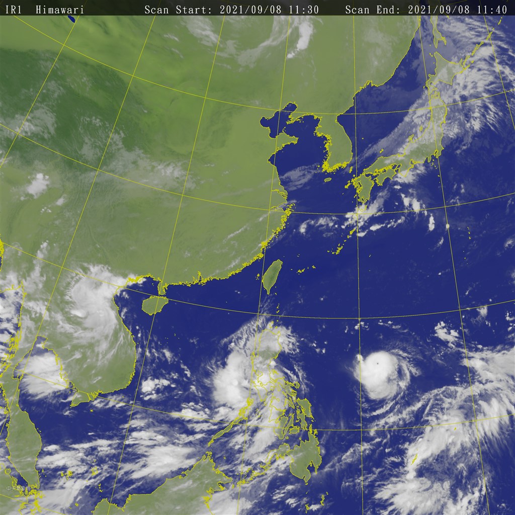
Satellite view of Western Pacific. (CWB image)
GIF of Western Pacific. (NOAA image)
GIF of Typhoon Chanthu. (NOAA image)
Supertyphoon #Chanthu: from a tropical depression to a Category 5 (equivalent) in two days… an absolutely stunning intensification rate. #KikoPH pic.twitter.com/nPgZ5KFn2f — Brian McNoldy (@BMcNoldy) September 8, 2021
Yesterday’s rapid intensification (an estimated 90 kt in 24 hours!) of Typhoon #Chanthu as viewed by the Himawari-8 satellite. pic.twitter.com/etMexjQYz3 — Dr. Kim Wood (@DrKimWood) September 8, 2021
CWB mulls sea warning for Typhoon Chanthu
 ]
]
Are you a robot?
]
Why did this happen?
Please make sure your browser supports JavaScript and cookies and that you are not blocking them from loading. For more information you can review our Terms of Service and Cookie Policy.