Typhoon In-Fa will bring heavy rain to Taiwan starting today
 ]
]
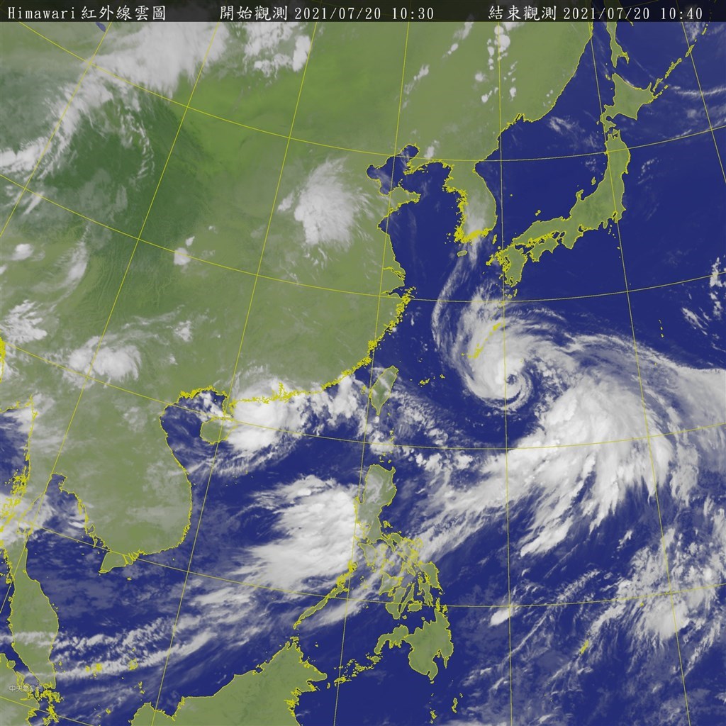
TAIPEI (Taiwan News) — Tropical Storm In-Fa (烟花) intensified into a typhoon Tuesday evening (July 20) and is expected to bring heavy rain from Wednesday through Saturday (July 22-24), when it will be closest to Taiwan.
As of 2 a.m. this morning (July 21), Typhoon In-Fa was 680 kilometers east of Taipei, moving west-northwest at a speed of 11 kilometers per hour. It had a radius of 180 km and was packing maximum sustained winds of 126 kph with gusts of up to 162 kph.
This morning, the Central Weather Bureau (CWB) issued a warning for large waves along the northern and eastern coasts as well as Orchid Island, Green Island, the Hengchun Peninsula, and Matsu. Presently Yilan County’s Su-ao Township and Taitung County’s Orchid Island are reporting waves in excess of 2 meters.
JTWC map of In-Fa’s projected path. (JTWC image)
Early this morning, the CWB issued a heavy rain advisory for Kaohsiung, Pingtung County, and the Hengchun Peninsula as In-Fa’s periphery nears. Residents of these areas are advised to beware of localized heavy rain, lightning strikes, and strong gusts.
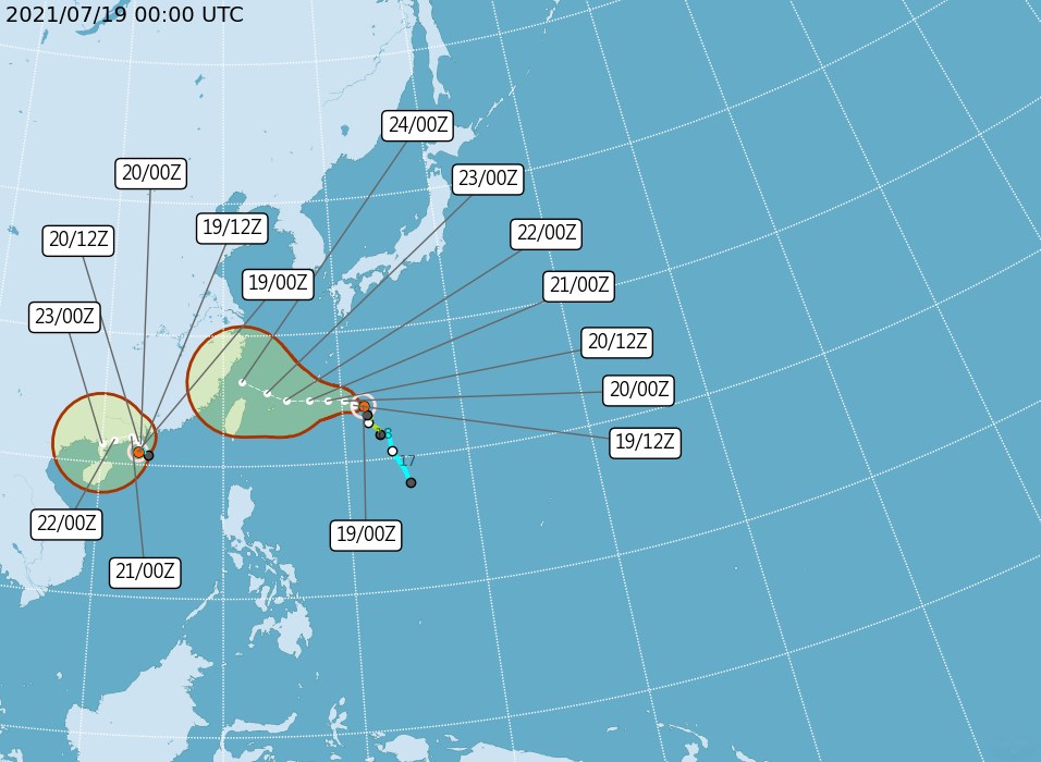
Meteorologist Wu Der-rong (吳德榮) said that In-Fa is continuing to gain in intensity and is closing in on Taiwan. However, he said that the European Centre for Medium-Range Weather Forecasts’ (ECMWF) current model shows the predicted path of the typhoon has shifted slightly north.
CWB map of In-Fa’s predicted path. (CWB image)
Based on the ECMWF model and the forecasts of other weather agencies, including the CWB, Wu said that the probability of In-Fa making landfall in Taiwan has been reduced and that the likelihood it will veer just north of the country has increased. Nevertheless, Wu stressed that there are many factors influencing the typhoon’s movements, including a low-pressure monsoon, a Pacific high-pressure ridge, and a northern air mass, meaning there is a high degree of uncertainty in the current weather models, and In-Fa could change course at any time.
Wu predicted that rainfall will grow in intensity in the north this evening and gradually spread to the center of the country. He also forecast local afternoon showers in the south.
JMA map of In-Fa’s predicted path. (JMA image)
Wu said In-Fa will be closest to Taiwan from Thursday to Saturday. During this period, the periphery of the storm will bring heavy rain to northern and central Taiwan and, to a lesser extent, southern Taiwan.
By Sunday (July 25), Wu predicted that In-Fa will be far from Taiwan and be replaced with southwesterly winds, which will likely bring extensive precipitation through July 29.
Tropical Storm Cempaka upgraded to typhoon
 ]
]
Tropical Storm In-Fa could become typhoon
 ]
]